This morning I deleted my G+ account for a certain reason and then took a look at the geocaching.com map. I was wondering whether to go for the caches I hadn’t managed yesterday, when I only got home at 9:22 PM, and only because my brother drove me back, or to try something bigger.
In the end I decided to try the “Muskareni” (Fly Fishing) power trail by TryskacMcKac. What had always put me off was that it was far away, but this time I told myself I needed to lose some weight anyway, so a longer walk wouldn’t hurt. That walk ended up being 23.9 km of pure walking today. At home I just printed out the hints for the individual caches, and all that was left was to decide whether to go via Stritez or via Tranovice. I went through Stritez yesterday, so I figured I’d try Tranovice today. This time, though, I didn’t set off at such a fast pace as I did yesterday at the start.
I walked slowly and reached Tranovice, where I made a little “detour” a short way off the path to buy something to drink and some food. I almost always buy 2 bottles of mineral water, so this time I got Rajec Gooseberry and Dobra voda Orange. 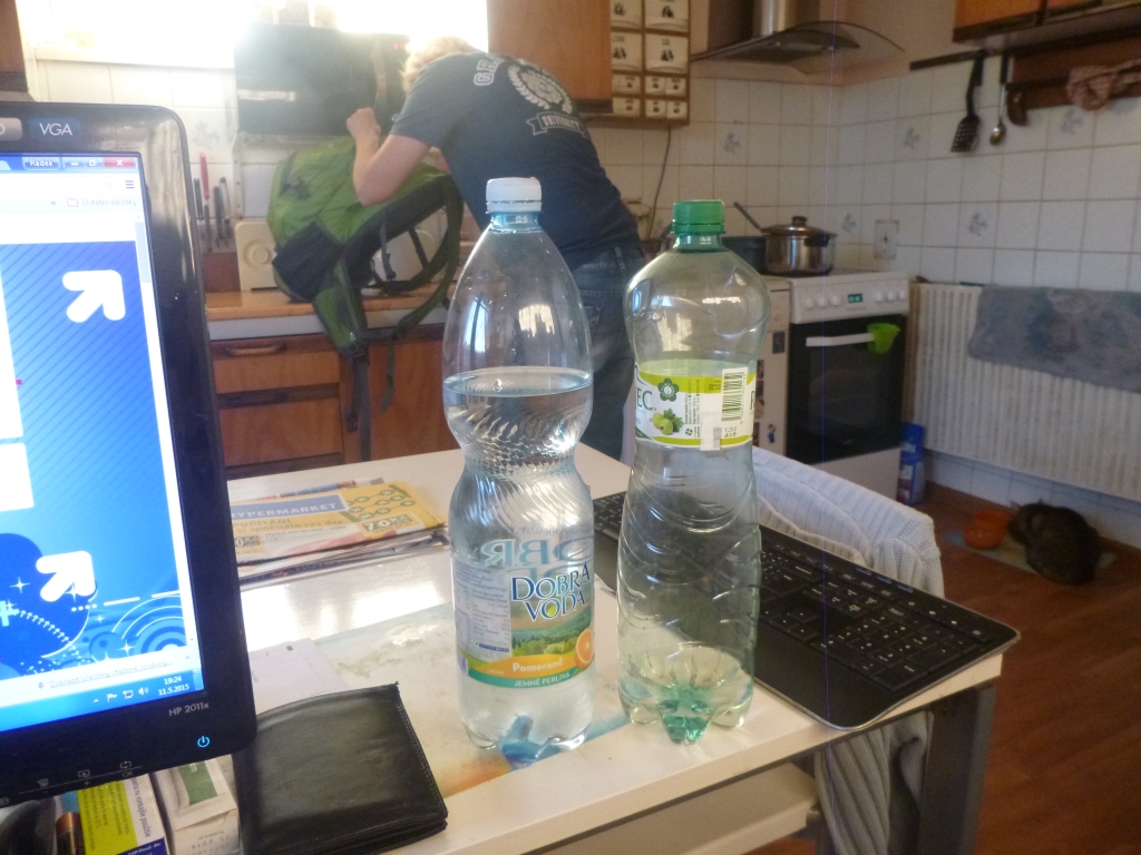
This is exactly how much water I had left after almost 10 hours of trekking – hardly any of the Rajec, and almost all of the Dobra voda. When I saw they had discounted Romance wafers for 5.50 CZK, I grabbed two of them as well. I don’t know whether they charged me correctly for the water, I’m not sure about that, but what I do know is that they charged me 5.90 CZK for each Romance. But I don’t fuss over amounts like that, and I don’t have to, so I put it all in my backpack and left without any trouble. I wanted to pay cash, but when I saw they had a contactless payment terminal, I paid by card.
I also had to wait at the checkout for about 5 minutes, because apparently nobody wanted my money. But at least I had the good feeling that I hadn’t stolen it, which I don’t think I’ve ever done, not that I know of. Outside I had a little to drink, only a little, because I was afraid that 3 liters of fluids wouldn’t be enough, and even if they were, I wanted to save as much as possible for later.
So I left Tranovice and headed toward Horni Tosanovice. By the time I got there, I didn’t feel like walking anymore and told myself I’d grab a few caches and head home. This really wasn’t how I’d imagined it in the morning. I wanted to find out, using various services, where the Vojkovice-Stred bus stop was. But the Mapy.cz WP app couldn’t even find the stop, no matter how I typed it in. The Mapy.cz web app did know the stop, but the map flickered so much that you couldn’t make anything out. I also tried the maps in the geocaching.com app, but those didn’t show bus stops.
So I had to take the risk. I more or less knew which stop it was, but I don’t remember ever being at it, and when I drive past by car, I don’t pay attention to where the stops are. I rode 2 stops: the 1st was Dolni Tosanovice, Na Chechluvce, and I got off at the next one, Vojkovice, Stred. So I traveled 4 km for 16 CZK, and I had waited for that bus for almost 30 minutes. That turned out to be the perfect choice in the end, because right behind the stop there was a turnoff, from where it was just a short walk to another village, Horni Domaslavice. Only one dog came at me, some long-haired dachshund, and otherwise the path was perfectly quiet, just the way I love it. The first cache, listed as a traditional, I found with no trouble.
It was simply placed between two trees. To get to the second cache I had to go the long way around, because I was still afraid to wade. I searched for it for a long time. The hint was “Tree-like shrub“, and I searched a really big bush several times to see if it was hidden somewhere in there, along with some “octopuses“, meaning impenetrable smaller bushes. Later Raduska wrote to me that it’s hard to find among the leaves, so if I ever show up there again, I’ll know. I had messaged Raduska from the geo-team, but she was busy at work and didn’t reply, so I moved on to number 3.
I crossed the same bridge as on the way to 2, just on the other side of the road. Here Raduska wrote back what I’d already guessed, namely that she couldn’t write. Fortunately, I did find the 3rd cache. The hint “hanging” meant it was at the foot of a tree, though it can also hang just a few centimeters above the ground. That’s when I realized that hanging doesn’t mean somewhere up in a tree – that would have helped me with other caches too, where I always assumed “hanging” meant somewhere high up, when it can be just like it was here. It actually makes sense in its own way: a cache is less conspicuous when it’s near the ground, covered with stones or sticks, than when even a photo plane can spot it from above. And then I asked myself, now what?
I could stick to just 1 side, but if I failed to find one cache, I wouldn’t get the coordinates for the next. So I concluded that I really had to start wading, because I had found 2 out of 3 caches, and as I said, just 1 miss and I wouldn’t be able to continue on my side and would have to cross over anyway.
You see, every cache contained coordinates for the next 2 caches, one on the left bank and the other on the right. So I pulled out of my backpack a pair of shoes from a Vietnamese market stall that cost 100 CZK, made of “one piece of plastic/rubber” with a sole without any tread at all, took off my socks and stowed my sneakers with the socks. I couldn’t even close the backpack, and half my things nearly fell out. Luckily, at one of the caches I took the backpack off and rearranged everything so it would close completely. I stepped onto a stone. The problem, as you can probably guess, was that I was afraid the water would be colder than I could stand.
After all, the last time I involuntarily fell into water while geocaching was on March 6, 2013, when I fell off a steep bank. Back then I was wearing normal shoes, and by the time I got out of the water they were completely soaked, so I had to call for a ride. Or I worried that I’d step in, get a cramp somewhere in the back of my leg, fall into the water, first get hypothermia and then freeze there because the cramp would keep getting worse.
I was also worried that the spot where I first crossed was the deepest – the water came up to my knees. In the end, though, I stepped in despite my “fear of water“. My first feeling was “brrr“, but before I had even reached the other side, slowly and carefully, I was already happy that I had (even though it’s nothing earth-shattering) overcome myself and my fear.
And on the other side I didn’t even “pour out” my shoes. They really deserved to be wiped dry, because for a large part of the way I walked right along the river, where there were flat concrete blocks that sloped toward the water, and over the course of the day I must have slipped about 35 times. Nothing ever happened to me, and luckily I didn’t lose anything either. Only once did I get my hands a bit muddy, because it was wet there, and whenever I slipped I’d stretch out my hand and break the fall, usually on my left side.
And it wasn’t just mud all the time, there was moss too, or the concrete was simply wet, and since I didn’t change shoes again, I had “no” sole to speak of. All in all, that day I crossed the river maybe more than 30 times, of which at most 8 times were other rivers and tributaries. And as I wrote on FB, sometimes I crossed the river just for the fun of it. For example, when there was a dog on my side, or when the other side had a slightly better path. With the dog I took it to the point where I crossed to the other side and then, 20 m further on, crossed back, because it was impossible to get through there :D.
There were also quite a few bridges along the way, and some of them had a cache right on them – but nothing complicated, just tucked into the railing. Or into the guardrail, if it was a bridge for cars too. The whole route was very pleasant, apart from a few moments I’d rather not have experienced. By far the biggest trouble was caused by cache #11, but I’ll get to that when I describe the individual caches. I’ve already described the first 3 caches, so on to the next, the fourth. I found it easily, if only because an orange lid was poking out from behind a smaller stone.
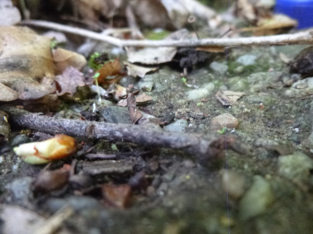
Besides, over those 300 found caches I’ve learned a thing or two and I’m slowly improving my GC instinct. The next one, the fifth cache, was a piece of cake. It was supposed to be under a stone, but it was in a concrete pipe, on the traditional string of course. At this cache my pen also ran out, so I had to take out a new one. What I liked was that I put the camera on the ground, the shutter somehow fired by itself, and this was the result without any settings at all:
The second cache where I messaged Raduska was number six. There was no actual tree stump there, and I’m not completely sure, but I definitely tried entering the coordinates into the GPS again, in case I had typed them in wrong and only happened to be by the river by coincidence. But the coordinates were correct, and so was my position.
Here Raduska wrote that it didn’t ring a bell for her, after I had sent her a photo of a stump and asked whether she could describe where it was. The coordinates pointed exactly at the stump I’d photographed, too. I admit it was a silly idea on my part. I should also say that for 90% of today’s caches, the device always showed the cache as being in the middle of the river! So I don’t know whether there happened to be floods when they made those maps, or what’s going on, because otherwise the GPS is very accurate, unless there’s a river that’s particularly big.
And this happens to me all the time near rivers, so it must be a problem with the GPS, or rather with the maps. With number seven I had no trouble. There were several stumps, but about 2 m apart, so that was enough to pinpoint the right stump. Number eight – in the railing – I’ve already talked about that.
Number nine – by the weir. This is where I last messaged Raduska, but she didn’t reply anymore. I assumed it would be somewhere in that right-hand corner:
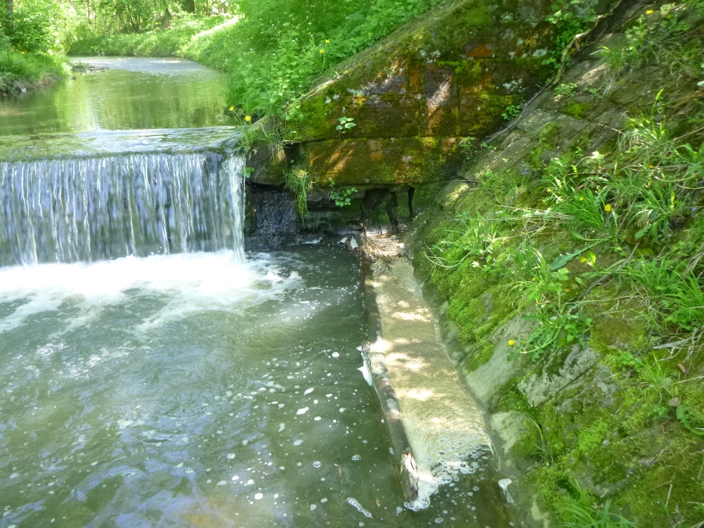
But the water there was maybe a meter deep, and I didn’t want any of my electronics to short out, so I gave up on this one too. So by this cache I had missed 3 caches and found 6. Number 10 was easy again, in the woods a short way from the path, with a beautiful well-trodden geo-highway leading to it. Around this time I was also sending a few people photos of me standing in the water and the view of the Lucina river from the middle of its stream.
Number 11 gave me the hardest time. I wanted to reach it without having to walk past a house with dogs, but there was forest everywhere and it was absolutely impenetrable! Not a single path or gap anywhere I could get through. So I had to go back to the main road into Vojkovice, walk all the way around and finally cross the river. By now I was a bit unhappy that it had taken me so long to get there, and when I still hadn’t found the cache after about 15 minutes (hint “triple tree“), I crossed to the other side and searched there as well. My stomach was growling, because the last time I’d eaten was yesterday, I hadn’t had anything today, and I had only drunk about 0.3 l. I was completely dazed and foggy by then; I couldn’t even tell whether I was on the left or the right bank, or where I had come from.
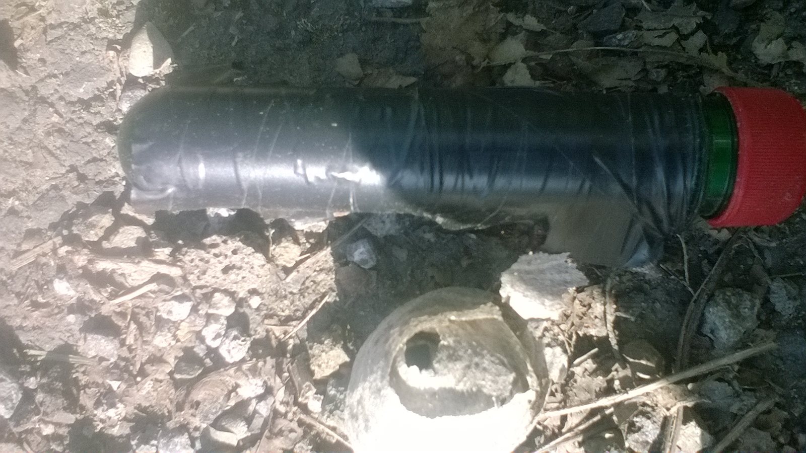
Maybe that’s why there were caches I didn’t find even after searching absolutely everywhere. I don’t know whether it was because I drank only 1.5 l of water the whole day, or because I ate nothing at all, or simply because I was tired and foggy at the same time. But tired isn’t the right word, because otherwise it was fantastic. When I was at number twelve, I found some kind of insect nest on the opposite side from where the coordinates pointed. I had already been searching there for 15 minutes and still nothing, so I searched the other side too.
I pulled out the nest and then randomly reached into a spot that occurred to me – and there was the cache. The nest looked something like this:
And the place where the nest was hidden looked like this:
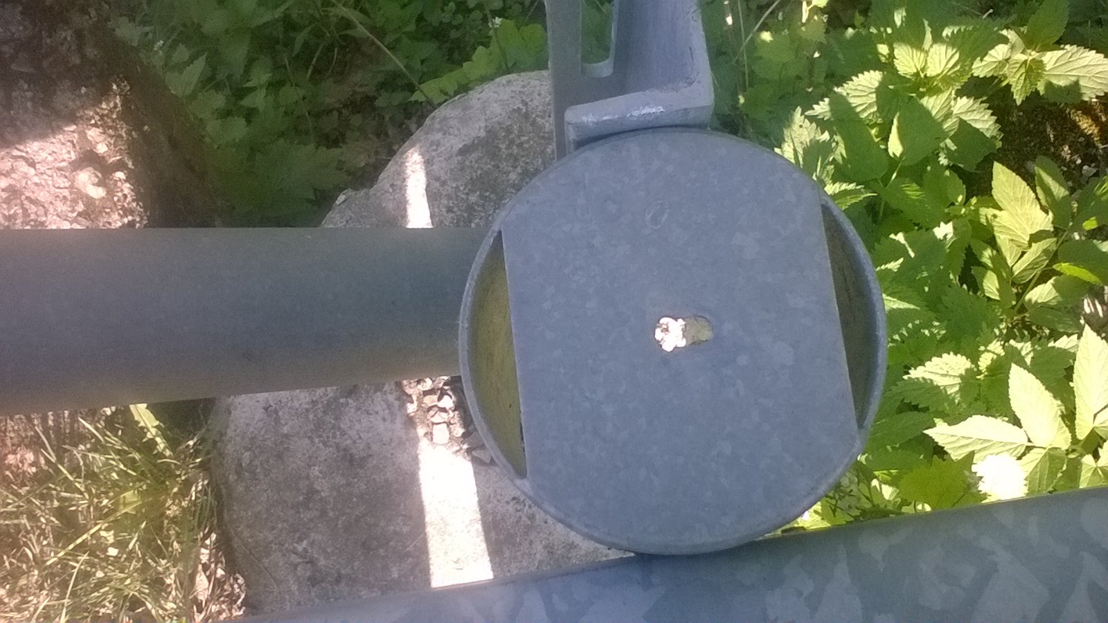
I don’t know what that’s called, I’m no builder. I walked along the path toward 13 and wanted to cut across a field, but at the corner of the field there was a gray-haired man doing something with a fence. I said hello and asked him whether it was his field and, if so, whether I could cross it to the other side, and I shyly added that I had a “treasure” over there and that it was a kind of “game“. But the man told me that everyone goes to the opposite side and that there are loads of them. I looked at my GPS and had to admit he was right.
He didn’t know some words and things, like “GPS” or “cache”, but otherwise he said that an acquaintance had told him there was a series along the river, and that he once went to see whether he could find it too, and he did – without GPS, coordinates, anything. And he laughed so heartily that it put me in a good mood too. Finally I asked him whether I could cross to the other (correct) side after all. He said the field was his, but that a farmer of his grew something there, and that yes, I could :). So I walked with long strides to trample as little as possible, and found it.
At cache 14 I came across some young lad on the path, and seeing him I understood exactly what I was missing, because it was radiating from him. He mumbled something, but I didn’t understand him, though for the first tenth of a second I thought he was a cacher too and wanted to give me a tip. I posted photos from this cache on FB, so I’ll put them here as well: 👻 This content now exists only in my head and in this sentence..
Number 15 was a railing again, no problem. On the way to 16 I got mud in my shoes for the first time. I was walking along a forest footpath that was so waterlogged that I was not only losing my balance but also sinking into the mud, which couldn’t be avoided because it was everywhere. This cache was on the right, upstream, and then I went on to 17. There I went into a construction site, because I thought the cache would be on the left side again, since that had been the pattern for all 16 caches.
Wrong guess. When I couldn’t find any roots of big old trees there, I went back and found it right away, except there was an anthill. When I was getting ready to step into the water for the first time, I had about 20 red ants on my camera; here, for a change, they were black ants. Once again I was a bit ungrateful toward the hint, but with a little imagination it made sense. So all in all, today I found 12 caches and missed 5, and I don’t have all the numbers for the bonus cache, but maybe someone will give me the missing numbers :).
You can see all of today’s photos that aren’t directly related to the caches at 👻 Server unplugged, cable coiled, keys returned., though they’re mostly photos of me standing in the water. I was also annoyed with MS, FB and the mobile operators, specifically O2. I normally use mobile data from O2/Tesco mobile, but T-Mobile simply has better 3G coverage, so I had to switch on my Kaktus SIM card, and 2 photos that had been uploading over EDGE for 5 minutes before showing the usual “unknown error” went through in about 10 seconds.
I’ve also been thinking about buying this little camera: https://digitalni-kamery.heureka.cz/xiaomi-yi-sport-camera/specifikace/#section but I still need to find out whether there’s a strap or headband available to mount it on my head. You can read one of the many reviews, for example, at https://www.svetandroida.cz/xiaomi-yi-recenze/ ; they write there, for instance, that it managed to record video at 1920×1080 px for a full 75 minutes, so I’ll keep looking into how long it can record at much lower resolutions.
The camera is one thing, but a short edit of me finding caches, a few minutes long at most, could be great :). I just wouldn’t include the sound: first, it isn’t very good quality, and second, there are those weird noises I sometimes make.. 😀 For those of you who aren’t my friends on FB, here’s a video of me crossing the river: https://www.flickr.com/photos/132352749@N05/17345131839/in/dateposted-public/ .
But it wasn’t always as easy and quick as it is here. Sometimes the bottom was deeper, sometimes it went up and down, sometimes the current was really wild, and I even had to walk diagonally. And one last thing: Peti was right when she wrote about how I wanted to kill myself and kept talking about it for 3 hours, even though she wrote lots of wise sentences, among them these 3:
[0:39:40] Petra Muhe: yeah, because you can’t fucking remember that you’ve felt good too, that [0:40:03] Petra Muhe: but I just know it…
[0:40:05] Petra Muhe: that it will be like that… I won’t go geocaching the day after, I have to wait until someone drives to Tesin so I can withdraw some money, but tomorrow I’ll dive right back in :).